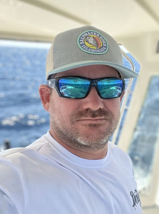
Know Where The Fish Are. Before You Leave The Dock.

AI-powered fishing intelligence. Daily satellite reports, species forecasts, weed line tracking, and chart analysis β€” from government satellite data to your dashboard.

Free tier available β€’ No credit card to start β€’ Built by a real charter captain

You Shouldn't Need a PhD to Read an SST Chart

Stop wasting time, fuel, and money on guesswork. Get the intelligence you need.

Raw satellite charts are confusing

Other services give you data. We give you answers. No more staring at colored blobs wondering what they mean.

Expert analysis costs a fortune

Traditional satellite fishing services charge $70+ per analysis. We deliver daily intelligence starting at $19/month.

You're wasting fuel and time

Stop running to blue water and hoping. Know exactly where the temp breaks, weed lines, and color changes are.

Everything You Need to Fish Smarter

Satellite intelligence, AI analysis, and real-time tracking β€” all in one platform.

πŸ›°οΈ

Daily Satellite Reports

SST, chlorophyll, currents, altimetry, wind, and pressure β€” analyzed by AI and delivered in plain English every morning at 5:30 AM.

🎯

Species Forecasts

Region-aware probability ratings with WHERE to find them and WHAT to use. Gulf, Atlantic, Keys, Pacific β€” we know the difference.

πŸ“‘

Chart Image Analysis

Upload a screenshot from your chartplotter, Garmin app, or any satellite tool. Our AI generates a full report from your image.

🌿

Weed Line Tracker

Satellite sargassum detection + current/wind drift projection. Know where the weed lines will be 6, 12, and 24 hours from now.

πŸ—ΊοΈ

Multi-Zone Coverage

Set up zones anywhere in the world. Drop a pin or paste GPS coordinates from your plotter. Switch between zones instantly.

πŸŒ™

Tides, Moon & Solunar

Moonrise, moonset, moon phase, illumination, tides, sunrise/sunset, and solunar ratings β€” all tuned to your exact zone.

How It Works

Three simple steps to better fishing intelligence.

1

Set Your Zone

Drop a pin, search, or paste GPS coordinates from your chartplotter. Any format works β€” we figure it out.

2

Wake Up Smarter

5:30 AM daily report on your dashboard. Satellite charts, species forecasts, conditions β€” while you drink your coffee.

3

Catch More Fish

Follow the intelligence. Save fuel. Find fish faster. Upload your charts for real-time analysis. Track weed lines as they drift.

Powered by Real Science

We pull from government satellites, federal ocean monitoring networks, and military-grade weather models. Then our AI turns it into fishing intelligence.

Government Satellites

Sea surface temperature, ocean color, and sargassum detection

Ocean Monitoring

Buoy networks, tide stations, and current measurements

Weather Models

Marine forecasts, wind, seas, and atmospheric pressure

AI Analysis Engine

Synthesizes everything into actionable fishing intelligence

Simple, Honest Pricing

Choose the plan that fits your fishing style. Start free, upgrade when you're ready.

Free

$0
  • Yesterday's report (24hr delayed)
  • Basic conditions summary
  • Web dashboard access
  • Set your fishing zone
Get Started

Angler

$19 /mo
  • Today's report at 5:30 AM
  • 1 fishing zone
  • 7 satellite charts (SST, chlorophyll, currents, wind, pressure & more)
  • Species forecasts with tactics
  • Tides, moon & solunar data
  • Email digest delivery
  • 30-day report archive
Get Started
MOST POPULAR

Captain

$39 /mo
  • Everything in Angler, plus:
  • 🌿 Weed line tracker with drift prediction
  • Species alert notifications
  • Priority email delivery
  • Advanced forecasting models
  • GPS coordinate input (any format)
Get Started

Fleet

$99 /mo
  • Everything in Captain, plus:
  • πŸ“‘ Upload charts for AI analysis
  • Unlimited fishing zones
  • Save zones from analyzed images
  • Export to CSV/JSON
  • Team crew accounts
  • Dedicated support
Get Started
Captain Kit Carson β€” Charter Captain and FishIntel Founder

Built By A Captain

FishIntel is built by Captain Kit Carson β€” a licensed charter captain running offshore out of Islamorada, Florida Keys.

25+ years in digital media. 10+ years on the water.

This isn't some Silicon Valley tech bro guessing about fishing. This is a captain who reads satellite charts every morning before running offshore β€” who built the tool he wished existed.

Stop Guessing. Start Catching.

Join hundreds of anglers and charter captains who fish smarter with AI-powered satellite intelligence.

Free tier available. No credit card required to start.